


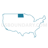
East Central North Dakota--Jamestown City PUMA, North Dakota
About
Outline

Summary
| Unique Area Identifier | 193683 |
| Name | East Central North Dakota--Jamestown City PUMA |
| State | North Dakota |
| Area (square miles) | 20,335.62 |
| Land Area (square miles) | 19,803.83 |
| Water Area (square miles) | 531.79 |
| % of Land Area | 97.38 |
| % of Water Area | 2.62 |
| Latitude of the Internal Point | 47.40640860 |
| Longtitude of the Internal Point | -98.91512740 |
Maps

Graphs
Select a template below for downloading or customizing gragh for East Central North Dakota--Jamestown City PUMA, North Dakota


Neighbors
Neighoring Public Use Microdata Area (by Name) Neighboring Public Use Microdata Area on the Map
- Cass County--Fargo City PUMA, ND
- Clay, Polk, Roseau, Pennington, Marshall, Norman, Kittson & Red Lake Counties PUMA, MN
- Northeast North Dakota--Grand Forks City PUMA, ND
- Northeast South Dakota PUMA, SD
- South Central North Dakota--Bismarck City PUMA, ND
- West Central Minnesota PUMA, MN
- West North Dakota--Minot City PUMA, ND
Top 10 Neighboring County (by Population) Neighboring County on the Map
- Cass County, ND (149,778)
- Burleigh County, ND (81,308)
- Grand Forks County, ND (66,861)
- Clay County, MN (58,999)
- Brown County, SD (36,531)
- Stutsman County, ND (21,100)
- Richland County, ND (16,321)
- Rolette County, ND (13,937)
- Ramsey County, ND (11,451)
- Walsh County, ND (11,119)
Top 10 Neighboring County Subdivision (by Population) Neighboring County Subdivision on the Map
- Jamestown city, Stutsman County, ND (15,427)
- Wahpeton city, Richland County, ND (7,766)
- Devils Lake city, Ramsey County, ND (7,141)
- Valley City city, Barnes County, ND (6,585)
- Turtle Mountain UT, Rolette County, ND (6,000)
- North Rolette UT, Rolette County, ND (3,517)
- Breckenridge city, Wilkin County, MN (3,386)
- Rugby city, Pierce County, ND (2,876)
- Bottineau city, Bottineau County, ND (2,211)
- Lisbon city, Ransom County, ND (2,154)
Top 10 Neighboring Place (by Population) Neighboring Place on the Map
- Jamestown city, ND (15,427)
- Wahpeton city, ND (7,766)
- Devils Lake city, ND (7,141)
- Valley City city, ND (6,585)
- Breckenridge city, MN (3,386)
- Rugby city, ND (2,876)
- Bottineau city, ND (2,211)
- Lisbon city, ND (2,154)
- Belcourt CDP, ND (2,078)
- Carrington city, ND (2,065)
Top 10 Neighboring Elementary School District (by Population) Neighboring Elementary School District on the Map
- Oberon Public School District 16, ND (339)
- Fort Ransom Public School District 6, ND (244)
- Pleasant Valley Public School District 35, ND (172)
- Robinson Public School District 14, ND (159)
Top 10 Neighboring Unified School District (by Population) Neighboring Unified School District on the Map
- Jamestown Public School District 1, ND (17,945)
- Devils Lake Public School District 1, ND (11,062)
- Wahpeton Public School District 37, ND (9,424)
- Valley City Public School District 2, ND (8,135)
- Sisseton School District 54-2, SD (7,853)
- Belcourt Public School District 7, ND (6,202)
- Breckenridge Public School District, MN (5,035)
- Barnesville Public School District, MN (4,455)
- Bottineau Public School District 1, ND (4,112)
- Rugby Public School District 5, ND (4,023)
Top 10 Neighboring State Legislative District Lower Chamber (by Population) Neighboring State Legislative District Lower Chamber on the Map
- State House District 9B, MN (39,347)
- State House District 3, SD (22,427)
- State House District 2, SD (21,657)
- State House District 22, ND (20,531)
- State House District 1, SD (20,515)
- State House District 8, ND (18,870)
- State House District 9, ND (13,937)
- State House District 12, ND (13,449)
- State House District 24, ND (13,443)
- State House District 23, ND (13,072)
Top 10 Neighboring State Legislative District Upper Chamber (by Population) Neighboring State Legislative District Upper Chamber on the Map
- State Senate District 9, MN (81,765)
- State Senate District 3, SD (22,427)
- State Senate District 2, SD (21,657)
- State Senate District 22, ND (20,531)
- State Senate District 1, SD (20,515)
- State Senate District 8, ND (18,870)
- State Senate District 9, ND (13,937)
- State Senate District 12, ND (13,449)
- State Senate District 24, ND (13,443)
- State Senate District 23, ND (13,072)
Top 10 Neighboring 111th Congressional District (by Population) Neighboring 111th Congressional District on the Map
- Congressional District (at Large), SD (814,180)
- Congressional District (at Large), ND (672,591)
- Congressional District 7, MN (625,512)
Top 10 Neighboring Census Tract (by Population) Neighboring Census Tract on the Map
- Census Tract 301.04, Clay County, MN (6,882)
- Census Tract 9418, Rolette County, ND (6,000)
- Census Tract 9674, Stutsman County, ND (5,672)
- Census Tract 9610, McLean County, ND (5,053)
- Census Tract 9508, Marshall County, SD (4,656)
- Census Tract 9517, Rolette County, ND (4,600)
- Census Tract 9520, Brown County, SD (4,412)
- Census Tract 9578, Ramsey County, ND (4,343)
- Census Tract 9576, Ramsey County, ND (4,263)
- Census Tract 9678, Stutsman County, ND (4,066)
Top 10 Neighboring 5-Digit ZIP Code Tabulation Area (by Population) Neighboring 5-Digit ZIP Code Tabulation Area on the Map
- 56560, MN (40,766)
- 58401, ND (17,142)
- 58301, ND (9,864)
- 58075, ND (9,276)
- 58072, ND (7,997)
- 58316, ND (6,486)
- 56520, MN (3,983)
- 58368, ND (3,801)
- 58318, ND (3,684)
- 58047, ND (3,560)